
Napollon topographic map
Interactive map
Click on the map to display elevation.
About this map
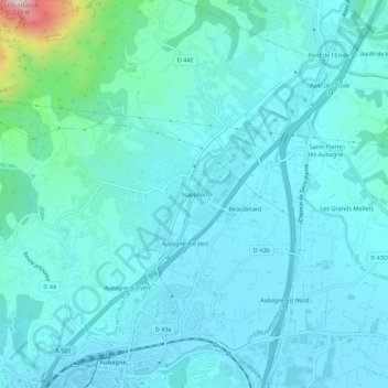
Name: Napollon topographic map, elevation, terrain.
Average elevation: 167 m
Minimum elevation: 97 m
Maximum elevation: 666 m
Other topographic maps
Click on a map to view its topography, its elevation and its terrain.
Parc Jean Moulin
France > Provence-Alpes-Côte d'Azur > Bouches-du-Rhône > Aubagne
Parc Jean Moulin, La Coueste, Aubagne, Marseille, Bouches-du-Rhône, Provence-Alpes-Côte d'Azur, France métropolitaine, 13400, France
Average elevation: 126 m
Le Garlaban
France > Provence-Alpes-Côte d'Azur > Bouches-du-Rhône > Aubagne
Le Garlaban, Aubagne, Marseille, Bouches-du-Rhône, Provence-Alpes-Côte d'Azur, France métropolitaine, 13400, France
Average elevation: 458 m