Geolocate

Olney topographic map

Click on the map to display elevation.

About this map
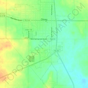
Name: Olney topographic map, elevation, terrain.

Location: Olney, Young County, Texas, 76374, United States (33.34046 -98.77693 33.37977 -98.74298)

Average elevation: 366 m

Minimum elevation: 351 m

Maximum elevation: 384 m

Other topographic maps

Click on a map to view its topography, its elevation and its terrain.
Graham

United States > Texas > Young County

Average elevation: 332 m

Gear up for your next adventure:

🎒Backpack Rain Covers - Universal waterproof covers to protect your gear from downpours
🧥Breathable Waterproof Jackets - Essential rain protection for the unpredictable British climate
🛌Sleeping Mats - Insulated mats for comfortable outdoor sleeping
👖Convertible Hiking Trousers - Versatile zip-off pants for changing mountain weather conditions
🪢Paracord - Multi-purpose cord for camping and survival

As an Amazon Associate, this site earns from qualifying purchases at no extra cost to you.