Geolocate

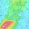
Mud Volcano topographic map

Click on the map to display elevation.

About this map

Name: Mud Volcano topographic map, elevation, terrain.

Location: Mud Volcano, Kaohsiung, 823, Taiwan (22.88336 120.39340 22.88346 120.39350)

Average elevation: 47 m

Minimum elevation: 16 m

Maximum elevation: 94 m

Other topographic maps

Click on a map to view its topography, its elevation and its terrain.

Linnei Village

Taiwan > Kaohsiung > Zhongcuo

Average elevation: 11 m

Xishan Village

Taiwan > Kaohsiung

Average elevation: 8 m

柴山

Taiwan > Kaohsiung

Shoushan is located in southern Taiwan within the vicinity of Kaohsiung stretching across the Gushan district. 5.5 Kilometres long from North to South and 2.5 kilometers wide from East to West with and overall landmass of around 485 hectares. In terms of height, Shoushan reaches a maximum elevation at around…

Average elevation: 38 m

Meinong District

Taiwan > Kaohsiung

Average elevation: 131 m

Fengshan District

Taiwan > Kaohsiung

Average elevation: 17 m

Qishan District

Taiwan > Kaohsiung > 蕃薯寮

Average elevation: 95 m

Daliao District

Taiwan > Kaohsiung

Average elevation: 15 m

Fongshan Reservoir

Taiwan > Kaohsiung > Zhongcuo

Average elevation: 43 m

Gear up for your next adventure:

🦶Anti-Blister Balms - Protect your feet before long topographic expeditions
🧢Thermal Beanie Hats - Prevent heat loss from the head in windy summit conditions
🧵Survival Paracord - Multi-purpose cordage for emergency repairs and shelters
🔋Rechargeable Batteries - Eco-friendly power for headlamps and older GPS units
🧭Emergency Beacons - Safety beacons for remote outdoor locations

As an Amazon Associate, this site earns from qualifying purchases at no extra cost to you.