Geolocate

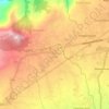
Aya topographic map

Click on the map to display elevation.

About this map

Name: Aya topographic map, elevation, terrain.

Location: Aya, Lapo-lapo I, San Jose, Batangas, Calabarzon, 4227, Philippines (13.88262 121.10701 13.90854 121.11965)

Average elevation: 271 m

Minimum elevation: 231 m

Maximum elevation: 316 m

Other topographic maps

Click on a map to view its topography, its elevation and its terrain.
Natunuan

Philippines > Batangas > San Jose

Average elevation: 191 m

Bagong Pook

Philippines > Batangas > San Jose

Average elevation: 174 m

Pinagtung-ulan

Philippines > Batangas > San Jose

Average elevation: 348 m

Lapo-lapo II

Philippines > Batangas > San Jose

Average elevation: 228 m

Dagatan

Philippines > Batangas > San Jose

Average elevation: 174 m

Tugtug

Philippines > Batangas > San Jose

Average elevation: 199 m

Taysan

Philippines > Batangas > San Jose

Average elevation: 235 m

Anus

Philippines > Batangas > San Jose

Average elevation: 214 m

Lumil

Philippines > Batangas > San Jose

Average elevation: 213 m

Sabang

Philippines > Batangas > San Jose

Average elevation: 219 m

Gear up for your next adventure:

🔭Compact Hiking Binoculars - Lightweight optics for scouting terrain and spotting wildlife
🧢Thermal Beanie Hats - Prevent heat loss from the head in windy summit conditions
⌚GPS Outdoor Watches - Watches with GPS tracking for hiking and exploration
⌚Altimeter Watches - Watches measuring altitude for mountain activities
🧥Waterproof Hiking Jackets - Rain protection for walking in all weather conditions

As an Amazon Associate, this site earns from qualifying purchases at no extra cost to you.