
Malika topographic map
Interactive map
Click on the map to display elevation.
About this map
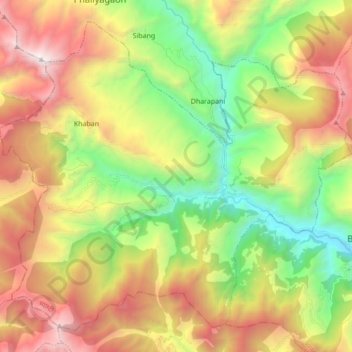
Name: Malika topographic map, elevation, terrain.
Location: Malika, Myagdi, Gandaki Province, 33208, Nepal (28.35425 83.27297 28.48748 83.44541)
Average elevation: 2,161 m
Minimum elevation: 968 m
Maximum elevation: 3,714 m
Other topographic maps
Click on a map to view its topography, its elevation and its terrain.