
Dubová topographic map
Interactive map
Click on the map to display elevation.
About this map
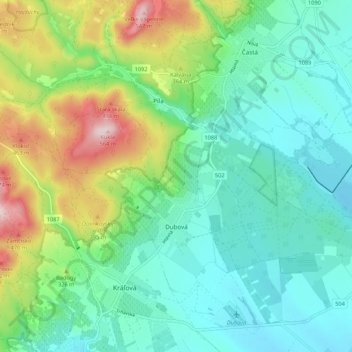
Name: Dubová topographic map, elevation, terrain.
Average elevation: 280 m
Minimum elevation: 180 m
Maximum elevation: 544 m
Other topographic maps
Click on a map to view its topography, its elevation and its terrain.
Bösing
Slowakei > Bratislavaer Landschaftsverband > Bezirk Bösing
Bösing, Bezirk Bösing, Bratislavaer Landschaftsverband, Slowakei
Average elevation: 300 m