
Bad Freienwalde (Oder) topographic map
Interactive map
Click on the map to display elevation.
About this map
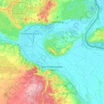
Name: Bad Freienwalde (Oder) topographic map, elevation, terrain.
Average elevation: 40 m
Minimum elevation: -2 m
Maximum elevation: 157 m
Other topographic maps
Click on a map to view its topography, its elevation and its terrain.
Birkenstein
Germany > Brandenburg > Märkisch-Oderland > Hoppegarten > Dahlwitz-Hoppegarten
Average elevation: 55 m