Geolocate

Harrislee topographic map

Click on the map to display elevation.

About this map
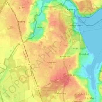
Name: Harrislee topographic map, elevation, terrain.

Location: Harrislee, Kreis Schleswig-Flensburg, Schleswig-Holstein, 24955, Germany (54.78123 9.34205 54.84261 9.42288)

Average elevation: 35 m

Minimum elevation: -2 m

Maximum elevation: 66 m

Other topographic maps

Click on a map to view its topography, its elevation and its terrain.

Gear up for your next adventure:

🥾Women's Waterproof Hiking Boots - High-performance trekking boots designed for all-weather comfort
⌚Altimeter Watches - Watches measuring altitude for mountain activities
🥫Expedition Meals - Lightweight, high-calorie nutrition for long-distance hikers
👖Packable Overtrousers - Quick-deploy rain protection for legs in sudden storms
🖼️Topographic Map Art - Decorative 3D-effect posters of famous UK peaks and regions

As an Amazon Associate, this site earns from qualifying purchases at no extra cost to you.