
Genval topographic map
Interactive map
Click on the map to display elevation.
About this map
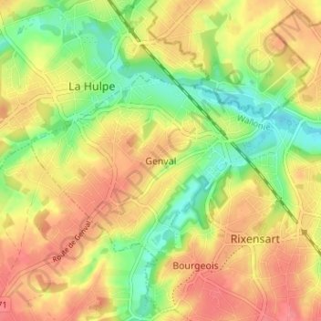
Name: Genval topographic map, elevation, terrain.
Location: Genval, Nivelles, Brabant wallon, Wallonie, 1332, Belgique (50.70201 4.48299 50.74201 4.52299)
Average elevation: 85 m
Minimum elevation: 46 m
Maximum elevation: 117 m