
Thank you for supporting this site ❤️
Make a donation
Make a donation
Gear up for your next adventure:
As an Amazon Associate, this site earns from qualifying purchases at no extra cost to you.
Jurbise topographic map
Click on the map to display elevation.
Thank you for supporting this site ❤️
Make a donation
Make a donation
Gear up for your next adventure:
As an Amazon Associate, this site earns from qualifying purchases at no extra cost to you.
About this map
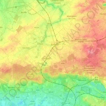
Name: Jurbise topographic map, elevation, terrain.
Location: Jurbise, Mons, Hainaut, Wallonia, 7050, Belgium (50.48874 3.79964 50.55519 3.99661)
Average elevation: 68 m
Minimum elevation: 16 m
Maximum elevation: 124 m
Thank you for supporting this site ❤️
Make a donation
Make a donation
Gear up for your next adventure:
As an Amazon Associate, this site earns from qualifying purchases at no extra cost to you.