
Llanarth topographic map
Click on the map to display elevation.
About this map
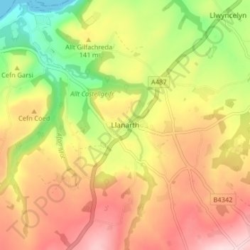
Name: Llanarth topographic map, elevation, terrain.
Location: Llanarth, Ceredigion, Wales, SA47 0NY, United Kingdom (52.17481 -4.32873 52.21481 -4.28873)
Average elevation: 134 m
Minimum elevation: 0 m
Maximum elevation: 252 m
Ceredigion trails, hiking, mountain biking, running and outdoor activities
Other topographic maps
Click on a map to view its topography, its elevation and its terrain.
Newcastle Emlyn Castle
United Kingdom > Wales > Ceredigion > Adpar > Bryndioddef
Average elevation: 78 m