
Chula topographic map
Click on the map to display elevation.
About this map
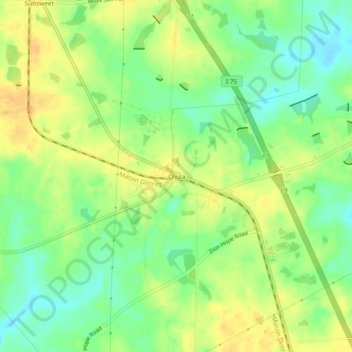
Name: Chula topographic map, elevation, terrain.
Location: Chula, Tift County, Georgia, United States (31.52963 -83.56739 31.56963 -83.52739)
Average elevation: 110 m
Minimum elevation: 93 m
Maximum elevation: 125 m
Other topographic maps
Click on a map to view its topography, its elevation and its terrain.