Geolocate

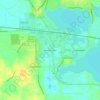
Silver Lake topographic map

Click on the map to display elevation.

About this map

Name: Silver Lake topographic map, elevation, terrain.

Location: Silver Lake, Kosciusko County, Indiana, United States (41.06477 -85.90246 41.08490 -85.88090)

Average elevation: 274 m

Minimum elevation: 256 m

Maximum elevation: 283 m

Other topographic maps

Click on a map to view its topography, its elevation and its terrain.

Gear up for your next adventure:

🍲Portable Camping Stoves - Fast-boiling stoves for hot meals on remote topographic survey trips
🧼Biodegradable Soap - Leave-no-trace hygiene for multi-day mountain treks
👟Waterproof Leg Gaiters - Keep mud and water out of your boots in boggy terrain
🧺Ultralight Dry Bags - Organize and waterproof your gear inside your rucksack
🧵Survival Paracord - Multi-purpose cordage for emergency repairs and shelters

As an Amazon Associate, this site earns from qualifying purchases at no extra cost to you.