
Réserve de parc national de l'Archipel-de-Mingan topographic map
Interactive map
Click on the map to display elevation.
About this map
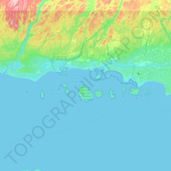
Name: Réserve de parc national de l'Archipel-de-Mingan topographic map, elevation, terrain.
Average elevation: 55 m
Minimum elevation: -1 m
Maximum elevation: 448 m
Other topographic maps
Click on a map to view its topography, its elevation and its terrain.
Lac Richard
Canada > Québec > Havre-Saint-Pierre > Havre-Saint-Pierre
Lac Richard, Havre-Saint-Pierre, Minganie, Côte-Nord, Québec, Canada
Average elevation: 108 m