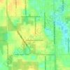
Deltona topographic map
Click on the map to display elevation.
Deltona
The majority of the land in the city is of karst topography, characterized by rolling hills and an abundant amount of lakes. The St. Johns River passes through Lake Monroe, directly south of the city. The United States Geological Survey lists the city's elevation at 33 feet (10 m) above sea level at a point near Deltona's geographic center. Elevations range from 20 feet (6.1 m) to 112 feet (34 m) above sea level. As of 2010, according to the United States Census Bureau, the city has a total area of 41.1 square miles (106.4 km2), 37.5 square miles (97.1 km2) of which is land and 3.5 square miles (9.1 km2) of which is water.
About this map
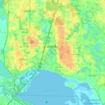
Name: Deltona topographic map, elevation, terrain.
Location: Deltona, Volusia County, Florida, United States (28.82107 -81.28243 28.96365 -81.15004)
Average elevation: 12 m
Minimum elevation: -3 m
Maximum elevation: 37 m
Other topographic maps
Click on a map to view its topography, its elevation and its terrain.
Samsula-Spruce Creek
United States > Florida > Volusia County > New Smyrna Beach > South Village
Average elevation: 8 m




Cypress Lake Park
United States > Florida > Volusia County > Cypress Lake Estates
Average elevation: 22 m
Halifax Estates
United States > Florida > Volusia County > Daytona Beach Shores
Average elevation: 1 m