
Thank you for supporting this site ❤️
Make a donation
Make a donation
Gear up for your next adventure:
As an Amazon Associate, this site earns from qualifying purchases at no extra cost to you.
Ferrarisi topographic map
Click on the map to display elevation.
Thank you for supporting this site ❤️
Make a donation
Make a donation
Gear up for your next adventure:
As an Amazon Associate, this site earns from qualifying purchases at no extra cost to you.
About this map
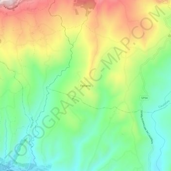
Name: Ferrarisi topographic map, elevation, terrain.
Location: Ferrarisi, Casalduni, Benevento, Campania, Italy (41.22144 14.64616 41.26144 14.68616)
Average elevation: 251 m
Minimum elevation: 73 m
Maximum elevation: 524 m
Thank you for supporting this site ❤️
Make a donation
Make a donation
Gear up for your next adventure:
As an Amazon Associate, this site earns from qualifying purchases at no extra cost to you.