
Thank you for supporting this site ❤️
Make a donation
Make a donation
Gear up for your next adventure:
As an Amazon Associate, this site earns from qualifying purchases at no extra cost to you.
Guerrero topographic map
Click on the map to display elevation.
Thank you for supporting this site ❤️
Make a donation
Make a donation
Gear up for your next adventure:
As an Amazon Associate, this site earns from qualifying purchases at no extra cost to you.
About this map
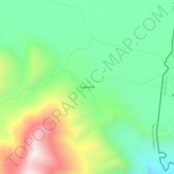
Name: Guerrero topographic map, elevation, terrain.
Location: Guerrero, San Ciro de Acosta, San Luis Potosí, Mexico (21.53468 -99.78995 21.57468 -99.74995)
Average elevation: 1,140 m
Minimum elevation: 799 m
Maximum elevation: 1,778 m
Thank you for supporting this site ❤️
Make a donation
Make a donation
Gear up for your next adventure:
As an Amazon Associate, this site earns from qualifying purchases at no extra cost to you.