
Thank you for supporting this site ❤️
Make a donation
Make a donation
Gear up for your next adventure:
As an Amazon Associate, this site earns from qualifying purchases at no extra cost to you.
Muzon topographic map
Click on the map to display elevation.
Thank you for supporting this site ❤️
Make a donation
Make a donation
Gear up for your next adventure:
As an Amazon Associate, this site earns from qualifying purchases at no extra cost to you.
About this map
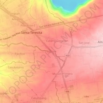
Name: Muzon topographic map, elevation, terrain.
Location: Muzon, San Luis, Batangas, Calabarzon, 4210, Philippines (13.84204 120.96467 13.88204 121.00467)
Average elevation: 164 m
Minimum elevation: -3 m
Maximum elevation: 219 m
Thank you for supporting this site ❤️
Make a donation
Make a donation
Gear up for your next adventure:
As an Amazon Associate, this site earns from qualifying purchases at no extra cost to you.