
Villnachern topographic map
Interactive map
Click on the map to display elevation.
About this map
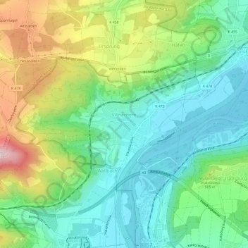
Name: Villnachern topographic map, elevation, terrain.
Location: Villnachern, Bezirk Brugg, Aargau, 5213, Zwitserland (47.46005 8.13478 47.48143 8.19378)
Average elevation: 446 m
Minimum elevation: 332 m
Maximum elevation: 684 m