
Zgornje Laze topographic map
Interactive map
Click on the map to display elevation.
About this map
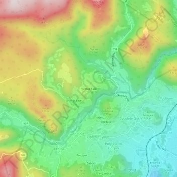
Name: Zgornje Laze topographic map, elevation, terrain.
Location: Zgornje Laze, Grabče, Gorje, 4270, Slovenia (46.37062 14.04498 46.41062 14.08498)
Average elevation: 717 m
Minimum elevation: 481 m
Maximum elevation: 1,083 m