
Thank you for supporting this site ❤️
Make a donation
Make a donation
Gear up for your next adventure:
As an Amazon Associate, this site earns from qualifying purchases at no extra cost to you.
A Silvosa topographic map
Click on the map to display elevation.
Thank you for supporting this site ❤️
Make a donation
Make a donation
Gear up for your next adventure:
As an Amazon Associate, this site earns from qualifying purchases at no extra cost to you.
About this map
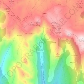
Name: A Silvosa topographic map, elevation, terrain.
Location: A Silvosa, Esteiro, Muros, La Coruña, Galicia, 15240, España (42.81378 -9.00733 42.85378 -8.96733)
Average elevation: 296 m
Minimum elevation: 19 m
Maximum elevation: 509 m
Thank you for supporting this site ❤️
Make a donation
Make a donation
Gear up for your next adventure:
As an Amazon Associate, this site earns from qualifying purchases at no extra cost to you.