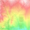
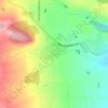
Beulah topographic map
Click on the map to display elevation.
About this map

Name: Beulah topographic map, elevation, terrain.
Location: Beulah, Pueblo County, Colorado, 81023, United States (38.05501 -105.00666 38.09501 -104.96666)
Average elevation: 2,013 m
Minimum elevation: 1,877 m
Maximum elevation: 2,326 m
Other topographic maps
Click on a map to view its topography, its elevation and its terrain.
Pueblo
United States > Colorado > Pueblo County
Pueblo has a steppe climate (Köppen BSk), with four distinct seasons. Winter days are usually mild, but the high does not surpass freezing on an average 15.3 days per year, and lows fall to 0 °F (−18 °C) or below on 7.8 nights. Snowfall usually falls in light amounts, and due to the high altitude, and the…
Average elevation: 1,487 m

Rye
United States > Colorado > Pueblo County
Rye has a subtropical highland climate (Köppen Cfb), a climate type usually associated with maritime regions, but is also found in high elevation areas in which summer temperatures are moderated by altitude. Precipitation exceeds that of semi-arid places, and average winter temperatures exceed freezing (O°C,…
Average elevation: 2,090 m
Rye
United States > Colorado > Pueblo County
Rye has a subtropical highland climate (Köppen Cfb), a climate type usually associated with maritime regions, but is also found in high elevation areas in which summer temperatures are moderated by altitude. Precipitation exceeds that of semi-arid places, and average winter temperatures exceed freezing (O°C,…
Average elevation: 2,090 m

Rye
United States > Colorado > Pueblo County
Rye has a subtropical highland climate (Köppen Cfb), a climate type usually associated with maritime regions, but is also found in high elevation areas in which summer temperatures are moderated by altitude. Precipitation exceeds that of semi-arid places, and average winter temperatures exceed freezing (O°C,…
Average elevation: 2,090 m