
Thank you for supporting this site ❤️
Make a donation
Make a donation
Gear up for your next adventure:
As an Amazon Associate, this site earns from qualifying purchases at no extra cost to you.
Bamba topographic map
Click on the map to display elevation.
Thank you for supporting this site ❤️
Make a donation
Make a donation
Gear up for your next adventure:
As an Amazon Associate, this site earns from qualifying purchases at no extra cost to you.
About this map
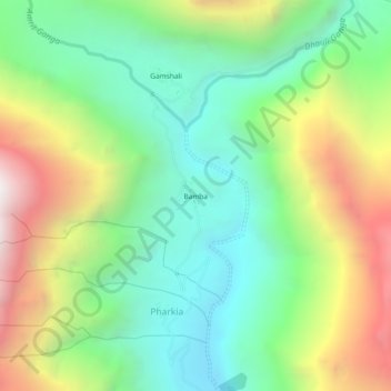
Name: Bamba topographic map, elevation, terrain.
Location: Bamba, Pharkia, Joshimath Tehsil, Chamoli, Uttarakhand, India (30.72367 79.80972 30.76367 79.84972)
Average elevation: 3,731 m
Minimum elevation: 3,089 m
Maximum elevation: 4,852 m
Thank you for supporting this site ❤️
Make a donation
Make a donation
Gear up for your next adventure:
As an Amazon Associate, this site earns from qualifying purchases at no extra cost to you.