Geolocate

Balag topographic map

Click on the map to display elevation.

About this map

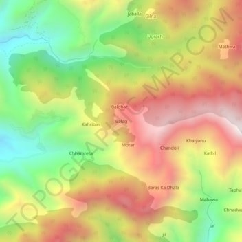
Name: Balag topographic map, elevation, terrain.

Location: Balag, Renuka, Sirmaur District, Himachal Pradesh, India (30.66641 77.48679 30.70641 77.52679)

Average elevation: 1,846 m

Minimum elevation: 1,310 m

Maximum elevation: 2,382 m

Gear up for your next adventure:

🧢Thermal Beanie Hats - Prevent heat loss from the head in windy summit conditions
🔋Rechargeable Batteries - Eco-friendly power for headlamps and older GPS units
🧢Waterproof Hiking Hats - Keep the rain off your face while studying topographic maps
📱Phone Mounts for Hiking - Secure mounts to carry your phone on trails
🗺️Scratch-off Peak Maps - Track your progress climbing Munros or Wainwrights

As an Amazon Associate, this site earns from qualifying purchases at no extra cost to you.