Geolocate

Akaki topographic map

Click on the map to display elevation.

About this map

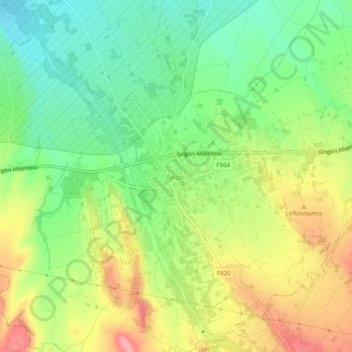
Name: Akaki topographic map, elevation, terrain.

Location: Akaki, Nicosia District, Cyprus, 2720, Cyprus (35.11453 33.10966 35.15453 33.14966)

Average elevation: 212 m

Minimum elevation: 165 m

Maximum elevation: 272 m

Gear up for your next adventure:

🔦Waterproof LED Headlamps - Hands-free lighting for evening treks and emergency navigation
🌂Windproof Trekking Umbrellas - Surprising but effective rain protection on low-wind trails
👟Men's Trail Running Shoes - Lightweight grip for fast movement over topographic contours
🥾Women's Waterproof Hiking Boots - High-performance trekking boots designed for all-weather comfort
❄️Walking Crampons - Added traction for icy slopes and winter peak bagging

As an Amazon Associate, this site earns from qualifying purchases at no extra cost to you.