
Isivilla topographic map
Interactive map
Click on the map to display elevation.
About this map
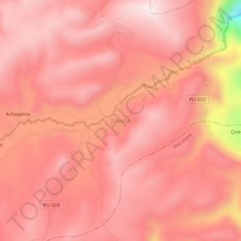
Name: Isivilla topographic map, elevation, terrain.
Location: Isivilla, Corani, Carabaya, Puno, Perú (-13.93688 -70.56286 -13.89688 -70.52286)
Average elevation: 4,393 m
Minimum elevation: 3,916 m
Maximum elevation: 4,524 m
Other topographic maps
Click on a map to view its topography, its elevation and its terrain.