Geolocate

Oha topographic map

Click on the map to display elevation.

About this map
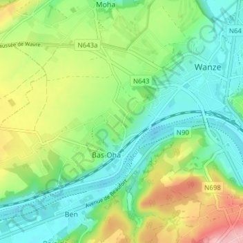
Name: Oha topographic map, elevation, terrain.

Location: Oha, Bas-Oha, Wanze, Huy, Liège, Wallonia, 4520, Belgium (50.50782 5.17206 50.54782 5.21206)

Average elevation: 117 m

Minimum elevation: 64 m

Maximum elevation: 219 m

Gear up for your next adventure:

🦶Anti-Blister Balms - Protect your feet before long topographic expeditions
🗺️Topographic Maps - Detailed maps showing elevation and terrain features
🔥Emergency Fire Starters - Reliable ignition tools for survival situations in damp conditions
🚲Bikepacking Frame Bags - Storage for tools and navigation gear on long off-road rides
🛌Insulated Sleeping Mats - Crucial thermal protection when sleeping on cold, uneven ground

As an Amazon Associate, this site earns from qualifying purchases at no extra cost to you.