Geolocate

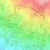
Benteng topographic map

Click on the map to display elevation.

About this map

Name: Benteng topographic map, elevation, terrain.

Location: Benteng, Sukabumi, West Java, 43135, Indonesia (-6.93919 106.89342 -6.89919 106.93342)

Average elevation: 586 m

Minimum elevation: 501 m

Maximum elevation: 721 m

Other topographic maps

Click on a map to view its topography, its elevation and its terrain.
Gear up for your next adventure:

🔋Lithium AA Batteries - Long-lasting power that performs well in cold mountain weather
🥼Base Layers - Thermal base layers for temperature regulation
👟Heavy Duty Boot Laces - Always carry a spare for your hiking footwear
🗺️Ordnance Survey Maps - Essential paper maps for hiking across the UK national parks
🧭Professional Hiking Compasses - High-precision liquid-filled compasses for map reading and orientation

As an Amazon Associate, this site earns from qualifying purchases at no extra cost to you.