
Lemoore topographic map
Interactive map
Click on the map to display elevation.
Lemoore
Lemoore (formerly, La Tache and Lee Moore's) is a city in Kings County, California, United States. Lemoore is located 7.5 miles (12 km) west-southwest of Hanford, at an elevation of 230 feet (70 m). It is part of the Hanford-Corcoran Metropolitan Statistical Area (MSA Code 25260). The population was 24,531 at the 2010 Census. The California Department of Finance estimated that Lemoore's population was 26,725 on July 1, 2019.
About this map
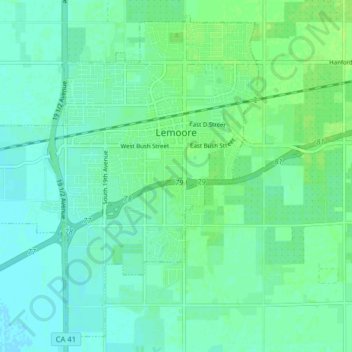
Name: Lemoore topographic map, elevation, terrain.
Location: Lemoore, Kings County, California, United States (36.26343 -119.84358 36.32195 -119.76404)
Average elevation: 66 m
Minimum elevation: 61 m
Maximum elevation: 72 m
Other topographic maps
Click on a map to view its topography, its elevation and its terrain.
Tulare Lake
United States > California > Kings County
It was separated from the rest of the San Joaquin Valley by tectonic subsidence and alluvial fans extending out from Los Gatos Creek in the Coast Ranges and the Kings River in the Sierra Nevada. Above a threshold elevation of 207 to 210 feet (63 to 64 m), it overflowed northward into the then-extant Summit…
Average elevation: 59 m
Corcoran
United States > California > Kings County
Corcoran is a city in Kings County, California. Corcoran is located 17 miles (27 km) south-southeast of Hanford, at an elevation of 207 ft (63 m). It is part of the Hanford–Corcoran Metropolitan Statistical Area. The population was 24,813 (2010 census), up from 14,458 (2000 census). The California Department…
Average elevation: 62 m
Hanford
United States > California > Kings County
The Hanford area was inhabited by the Tachi Yokut Indians for several thousand years prior to Euro-American contact. They occupied areas along watercourses such as creeks, springs and seep areas (such as sloughs), along perennial and seasonal drainages, as well as flat ridges and terraces. Therefore, the areas…
Average elevation: 73 m