Geolocate

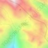
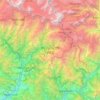
Mansuna topographic map

Click on the map to display elevation.

About this map

Name: Mansuna topographic map, elevation, terrain.

Location: Mansuna, Ukhimath, Rudraprayag District, Uttarakhand, 246469, India (30.52807 79.10405 30.56807 79.14405)

Average elevation: 1,653 m

Minimum elevation: 1,107 m

Maximum elevation: 2,494 m

Other topographic maps

Click on a map to view its topography, its elevation and its terrain.
Chorabari Glacier

India > Uttarakhand > Ukhimath > Kedarnath

Average elevation: 5,011 m

Lake Vasuki Tal

India > Uttarakhand > Ukhimath > Kedarnath

Average elevation: 4,303 m

Kedarnath Wildlife Sanctuary

India > Uttarakhand > Ukhimath

Located in the Himalayan Highlands with an elevation ranging from 1,160 metres (3,810 ft) (near Phata) to the Chaukhamba peak at 7,068 m (23,189 ft), it was a notified reserve forest between 1916 and 1920. It was changed to a sanctuary on 21 January 1972, and has been designated a "Habitat/Species Management…

Average elevation: 3,285 m

Lake Vasuki Tal

India > Uttarakhand > Ukhimath > Kedarnath

Average elevation: 4,303 m

Gear up for your next adventure:

🗺️Ordnance Survey Maps - Official UK maps for walking and outdoor activities
🍱Food Containers - Reusable containers for outdoor meals
📷Camera Straps - Secure straps for carrying cameras while walking
🔥Emergency Fire Starters - Reliable ignition tools for survival situations in damp conditions
🧣Neck Gaiters - Versatile protection against wind and cold

As an Amazon Associate, this site earns from qualifying purchases at no extra cost to you.