Geolocate

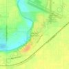
Elmhurst topographic map

Click on the map to display elevation.

About this map

Name: Elmhurst topographic map, elevation, terrain.

Location: Elmhurst, Anderson, Madison County, Indiana, 46011, United States (40.07782 -85.74137 40.11782 -85.70137)

Average elevation: 267 m

Minimum elevation: 250 m

Maximum elevation: 276 m

Other topographic maps

Click on a map to view its topography, its elevation and its terrain.
Gear up for your next adventure:

🧰Survival Kits - Emergency tools for remote environments
🔦Head Torches - Hands-free lighting for hiking and camping
🥤Hiking Water Bottles - Reusable bottles for hydration on the trail
🌦️Portable Weather Meters - Handheld tools for monitoring weather conditions
🛌Sleeping Mats - Insulated mats for comfortable outdoor sleeping

As an Amazon Associate, this site earns from qualifying purchases at no extra cost to you.