Geolocate

Fonte Grada topographic map

Click on the map to display elevation.

About this map
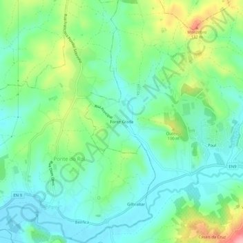
Name: Fonte Grada topographic map, elevation, terrain.

Location: Fonte Grada, Santa Maria, São Pedro e Matacães, Torres Vedras, Lisbon, 2560-249, Portugal (39.08478 -9.32439 39.12478 -9.28439)

Average elevation: 54 m

Minimum elevation: 11 m

Maximum elevation: 156 m

Other topographic maps

Click on a map to view its topography, its elevation and its terrain.

Turcifal

Portugal > Lisbon > Torres Vedras

Average elevation: 102 m

Gear up for your next adventure:

🔪Outdoor Multi-Tools - Versatile tools for gear repairs and food prep in the wild
🧤Thermal Touchscreen Gloves - Stay warm while operating your GPS or smartphone camera
🕶️Polarized Sunglasses - Reduces glare from snow and water when reading terrain
🎒Multi-day Trekking Packs - Large capacity backpacks for wild camping and long-distance trails
🥾Men's Waterproof Hiking Boots - Durable footwear with deep lugs for muddy and rocky UK terrains

As an Amazon Associate, this site earns from qualifying purchases at no extra cost to you.