
Greenville Old City Lake Dam topographic map
Interactive map
Click on the map to display elevation.
About this map
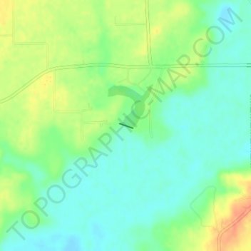
Name: Greenville Old City Lake Dam topographic map, elevation, terrain.
Average elevation: 158 m
Minimum elevation: 142 m
Maximum elevation: 183 m
Other topographic maps
Click on a map to view its topography, its elevation and its terrain.
Smithboro
United States > Illinois > Bond County
Smithboro, Bond County, Illinois, 62284, United States
Average elevation: 169 m
Greenville
United States > Illinois > Bond County
Greenville, Bond County, Illinois, 62246, United States
Average elevation: 165 m
Greenville
United States > Illinois > Bond County > Greenville
Greenville, Bond County, Illinois, 62246, United States
Average elevation: 166 m