
Le Lac de Loire topographic map
Interactive map
Click on the map to display elevation.
About this map
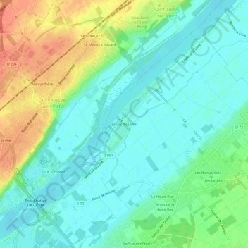
Name: Le Lac de Loire topographic map, elevation, terrain.
Average elevation: 82 m
Minimum elevation: 66 m
Maximum elevation: 115 m
Other topographic maps
Click on a map to view its topography, its elevation and its terrain.
Le Petit Roche
France > Centre-Val de Loire > Loir-et-Cher > Vineuil
Le Petit Roche, Vineuil, Blois, Loir-et-Cher, Centre-Val de Loire, France métropolitaine, 41350, France
Average elevation: 86 m
Les Sentiers de Pimpeneau
France > Centre-Val de Loire > Loir-et-Cher > Vineuil
Les Sentiers de Pimpeneau, Vineuil, Blois, Loir-et-Cher, Centre-Val de Loire, France métropolitaine, 41350, France
Average elevation: 81 m