
相资 topographic map
Interactive map
Click on the map to display elevation.
About this map
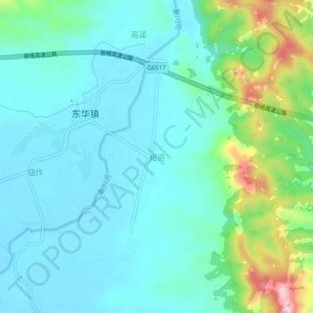
Name: 相资 topographic map, elevation, terrain.
Location: 相资, 平南县, 贵港市, 广西壮族自治区, 中国 (23.54740 110.52900 23.58740 110.56900)
Average elevation: 86 m
Minimum elevation: 32 m
Maximum elevation: 289 m