Geolocate

Terzo topographic map

Click on the map to display elevation.

About this map

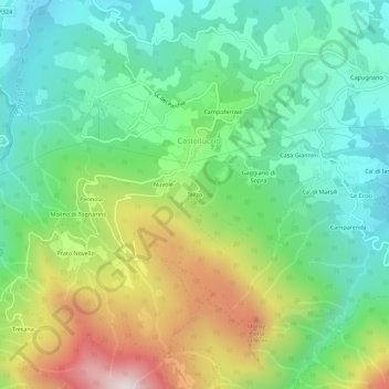
Name: Terzo topographic map, elevation, terrain.

Location: Terzo, Castelluccio, Alto Reno Terme, Unione dell'Alto Reno, Bologna, Emilia-Romagna, 40042, Italia (44.12629 10.90720 44.16629 10.94720)

Average elevation: 783 m

Minimum elevation: 452 m

Maximum elevation: 1,448 m

Other topographic maps

Click on a map to view its topography, its elevation and its terrain.

Gear up for your next adventure:

🧤Waterproof Overmitts - Extreme weather protection for hikers and mountaineers
🔭Compact Hiking Binoculars - Lightweight optics for scouting terrain and spotting wildlife
🌄Outdoor Binoculars - Compact binoculars for landscape observation
🛰️Satellite Messengers - Emergency communication devices for areas without mobile signal
🧦Hiking Socks - Breathable socks designed to prevent blisters on long walks

As an Amazon Associate, this site earns from qualifying purchases at no extra cost to you.