
Castro Daire topographic map
Interactive map
Click on the map to display elevation.
About this map
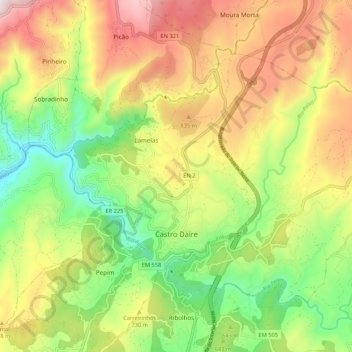
Name: Castro Daire topographic map, elevation, terrain.
Location: Castro Daire, Viseu, Viseu Dão-Lafões, Mitte, Portugal (40.88545 -7.96428 40.94384 -7.85764)
Average elevation: 673 m
Minimum elevation: 295 m
Maximum elevation: 1,131 m