
Ballyman topographic map
Interactive map
Click on the map to display elevation.
About this map
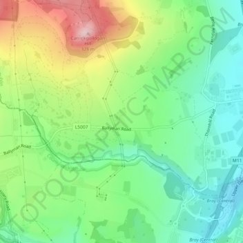
Name: Ballyman topographic map, elevation, terrain.
Average elevation: 99 m
Minimum elevation: 7 m
Maximum elevation: 261 m
Other topographic maps
Click on a map to view its topography, its elevation and its terrain.
Glencullen ED
Glencullen ED, Dublin 18, Dún Laoghaire-Rathdown, County Dublin, Leinster, Irland
Average elevation: 137 m