
Thank you for supporting this site ❤️
Make a donation
Make a donation
Gear up for your next adventure:
As an Amazon Associate, this site earns from qualifying purchases at no extra cost to you.
Balmenhorn topographic map
Click on the map to display elevation.
Thank you for supporting this site ❤️
Make a donation
Make a donation
Gear up for your next adventure:
As an Amazon Associate, this site earns from qualifying purchases at no extra cost to you.
About this map
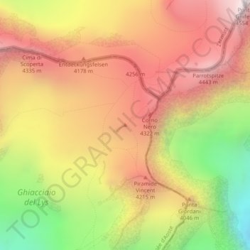
Name: Balmenhorn topographic map, elevation, terrain.
Location: Balmenhorn, Gressoney-La-Trinité, Aosta Valley, Italy (45.91379 7.85808 45.91389 7.85818)
Average elevation: 3,928 m
Minimum elevation: 3,099 m
Maximum elevation: 4,551 m
Thank you for supporting this site ❤️
Make a donation
Make a donation
Gear up for your next adventure:
As an Amazon Associate, this site earns from qualifying purchases at no extra cost to you.