Geolocate

Plosokerep topographic map

Click on the map to display elevation.

About this map

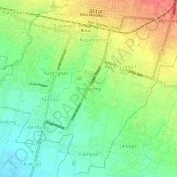
Name: Plosokerep topographic map, elevation, terrain.

Location: Plosokerep, Blitar, East Java, Java, 66134, Indonesia (-8.13571 112.14339 -8.09571 112.18339)

Average elevation: 156 m

Minimum elevation: 128 m

Maximum elevation: 193 m

Other topographic maps

Click on a map to view its topography, its elevation and its terrain.

Taman Kebonrojo

Indonesia > East Java > Blitar > Bendogerit

Average elevation: 185 m

Gear up for your next adventure:

🗺️Scratch-off Peak Maps - Track your progress climbing Munros or Wainwrights
🧼Technical Clothing Wash - Special soap to clean and restore waterproof membranes
🧴Tick Removal Tools - Small, essential health tool for UK woodland and moorland
📦Dry Bags - Waterproof bags to protect gear from rain
🧤Waterproof Overmitts - Extreme weather protection for hikers and mountaineers

As an Amazon Associate, this site earns from qualifying purchases at no extra cost to you.