
East Usambara Mountains topographic map
Interactive map
Click on the map to display elevation.
About this map
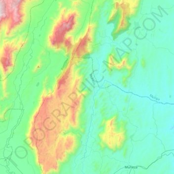
Name: East Usambara Mountains topographic map, elevation, terrain.
Location: East Usambara Mountains, Muheza, Tanga, Nordzone, Tansania (-5.19147 38.55377 -4.80910 38.81882)
Average elevation: 447 m
Minimum elevation: 76 m
Maximum elevation: 1,715 m
Other topographic maps
Click on a map to view its topography, its elevation and its terrain.