Geolocate

Strand topographic map

Click on the map to display elevation.

About this map

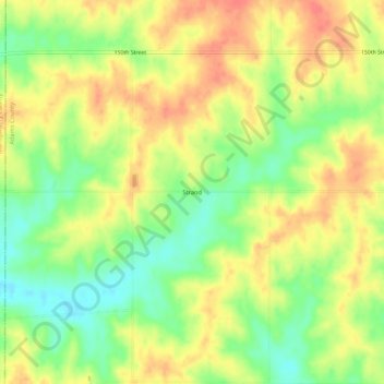
Name: Strand topographic map, elevation, terrain.

Location: Strand, Adams County, Iowa, United States (41.05221 -94.92193 41.09221 -94.88193)

Average elevation: 375 m

Minimum elevation: 343 m

Maximum elevation: 402 m

Other topographic maps

Click on a map to view its topography, its elevation and its terrain.

Carbon

United States > Iowa > Adams County

Average elevation: 345 m

Prescott

United States > Iowa > Adams County

Average elevation: 366 m

Nodaway

United States > Iowa > Adams County

Average elevation: 335 m

Corning

United States > Iowa > Adams County

Average elevation: 358 m

Gear up for your next adventure:

🚶Walking Pedometers - Simple distance tracking for casual trail walkers
🔋Rechargeable Batteries - Eco-friendly power for headlamps and older GPS units
🥾Hiking Boots - Waterproof and durable boots for long-distance hiking in the UK
🥾Walking Shoes - Lightweight walking shoes for countryside and coastal paths
🐕Dog Hiking Gear - Equipment for hiking safely with dogs

As an Amazon Associate, this site earns from qualifying purchases at no extra cost to you.