Geolocate

Patrang topographic map

Click on the map to display elevation.

About this map

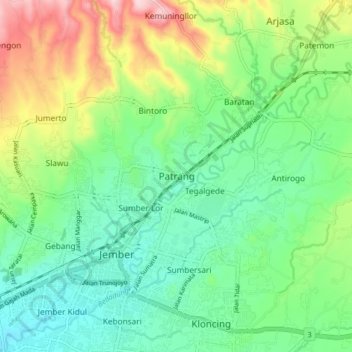
Name: Patrang topographic map, elevation, terrain.

Location: Patrang, Jember, East Java, Java, 68111, Indonesia (-8.19125 113.67594 -8.11125 113.75594)

Average elevation: 141 m

Minimum elevation: 58 m

Maximum elevation: 316 m

Gear up for your next adventure:

🧥Waterproof Hiking Jackets - Rain protection for walking in all weather conditions
👖Packable Overtrousers - Quick-deploy rain protection for legs in sudden storms
🧦Merino Wool Hiking Socks - Moisture-wicking socks to prevent blisters during long mountain walks
🌄Outdoor Binoculars - Compact binoculars for landscape observation
❄️Walking Crampons - Added traction for icy slopes and winter peak bagging

As an Amazon Associate, this site earns from qualifying purchases at no extra cost to you.