Geolocate

Bargteheide topographic map

Click on the map to display elevation.

About this map
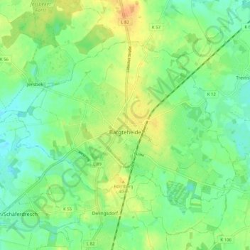
Name: Bargteheide topographic map, elevation, terrain.

Location: Bargteheide, Kreis Stormarn, Schleswig-Holstein, 22941, Germany (53.70961 10.20570 53.74950 10.30617)

Average elevation: 42 m

Minimum elevation: 28 m

Maximum elevation: 62 m

Other topographic maps

Click on a map to view its topography, its elevation and its terrain.

Fischbek

Germany > Schleswig-Holstein > Kreis Stormarn

Average elevation: 37 m

Gear up for your next adventure:

🎒Hiking Backpacks - Comfortable backpacks for day hikes and multi-day treks
🛌Sleeping Mats - Insulated mats for comfortable outdoor sleeping
⛺Camping Shelters - Emergency and lightweight shelters for outdoor use
🦶Anti-Blister Balms - Protect your feet before long topographic expeditions
🔥Emergency Fire Starters - Reliable ignition tools for survival situations in damp conditions

As an Amazon Associate, this site earns from qualifying purchases at no extra cost to you.