
Coyote Hills Slough topographic map
Interactive map
Click on the map to display elevation.
About this map
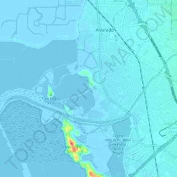
Name: Coyote Hills Slough topographic map, elevation, terrain.
Average elevation: 2 m
Minimum elevation: -4 m
Maximum elevation: 78 m
Other topographic maps
Click on a map to view its topography, its elevation and its terrain.
Coyote Hills Regional Park
United States > California > Alameda County > Fremont
Average elevation: 5 m