
Pinggan topographic map
Click on the map to display elevation.
About this map
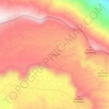
Name: Pinggan topographic map, elevation, terrain.
Location: Pinggan, Bangli, Bali, Lesser Sunda Islands, Indonesia (-8.22339 115.36714 -8.18339 115.40714)
Average elevation: 1,190 m
Minimum elevation: 665 m
Maximum elevation: 1,436 m