
Thank you for supporting this site ❤️
Make a donation
Make a donation
Gear up for your next adventure:
As an Amazon Associate, this site earns from qualifying purchases at no extra cost to you.
Vanguardia topographic map
Click on the map to display elevation.
Thank you for supporting this site ❤️
Make a donation
Make a donation
Gear up for your next adventure:
As an Amazon Associate, this site earns from qualifying purchases at no extra cost to you.
About this map
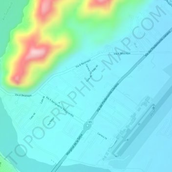
Name: Vanguardia topographic map, elevation, terrain.
Location: Vanguardia, Villavicencio, Meta, 500010, Colombia (4.16316 -73.63345 4.18316 -73.61345)
Average elevation: 455 m
Minimum elevation: 410 m
Maximum elevation: 648 m
Thank you for supporting this site ❤️
Make a donation
Make a donation
Gear up for your next adventure:
As an Amazon Associate, this site earns from qualifying purchases at no extra cost to you.