
Belen topographic map
Interactive map
Click on the map to display elevation.
About this map
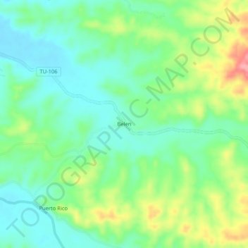
Name: Belen topographic map, elevation, terrain.
Location: Belen, Pampas de Hospital, Tumbes, Perú (-3.72589 -80.43165 -3.68589 -80.39165)
Average elevation: 58 m
Minimum elevation: 21 m
Maximum elevation: 133 m
Other topographic maps
Click on a map to view its topography, its elevation and its terrain.
Pampas de Hospital
Perú > Tumbes > Pampas de Hospital
Pampas de Hospital, Tumbes, Perú
Average elevation: 49 m