
Huai Khwang District topographic map
Interactive map
Click on the map to display elevation.
About this map
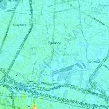
Name: Huai Khwang District topographic map, elevation, terrain.
Location: Huai Khwang District, Bangkok, 10310, Thailand (13.74110 100.56327 13.80310 100.60406)
Average elevation: 5 m
Minimum elevation: 0 m
Maximum elevation: 42 m
Other topographic maps
Click on a map to view its topography, its elevation and its terrain.
Bangkok
Bangkok is situated in the Chao Phraya River delta in Thailand's central plain. The river meanders through the city in a southerly direction, emptying into the Gulf of Thailand approximately 25 kilometres (16 mi) south of city centre. The area is flat and low-lying, with an average elevation of 1.5 metres (4…
Average elevation: 4 m