
La Groie topographic map
Interactive map
Click on the map to display elevation.
About this map
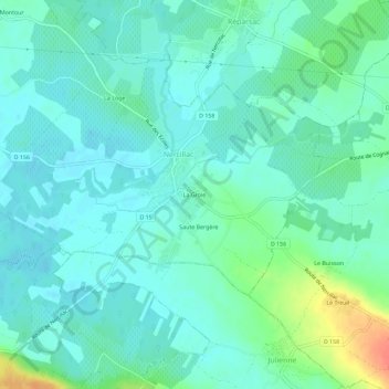
Name: La Groie topographic map, elevation, terrain.
Average elevation: 20 m
Minimum elevation: 8 m
Maximum elevation: 59 m
Other topographic maps
Click on a map to view its topography, its elevation and its terrain.
Montour
France > Nouvelle-Aquitaine > Charente > Nercillac
Montour, Nercillac, Cognac, Charente, Nouvelle-Aquitaine, France métropolitaine, 16200, France
Average elevation: 16 m